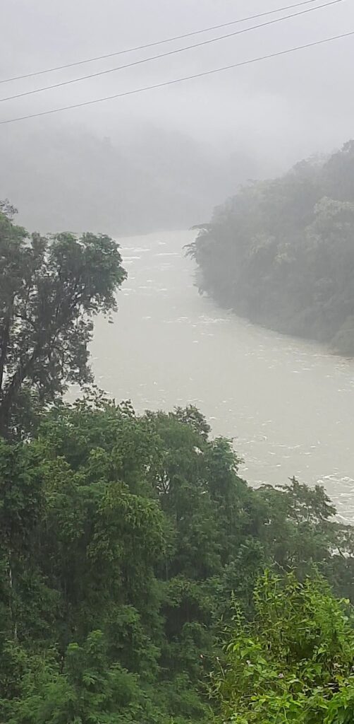
To cross over to Tibet from India one envisages traversing across snow bound passes. Nigh impossible in most seasons. But there is one all-weather pass which the Chinese used in the ’62 war for entering India to reach Walong. It was a maw so fiercely defended they called it the Tiger’s Mouth. Here in the eastern most Indian valley of Namti, the Himalayas part for the gushing, rushing Lohit. To call it a mere tributary of the mighty Brahmaputra is an exercise in semantics. There is nothing mere about the ferocious and unforgiving waters, cradled by steep ranges, covered in a canopy of evergreen forests constantly being fed by the rains and rivulets. Into this fecund land of excesses we take a driving holiday.
We have waited for the monsoon to retire but well into October and it seems to be on climate change steroids. And now cyclone Sitrang is heading our way so between Mechuka (where no flight will go for the next 2 weeks), Dzukou (trekking in the rain is not my idea of fun) and Walong, the safest(haha…!) bet is to sit dry in a vehicle and drive!
Tezu: A Foot in the Hills
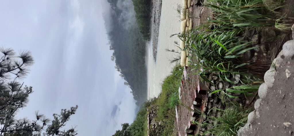
There is a light drizzle when we start and it keeps company through the day. The pot-holed bypass of Tinsukia is familiar till we take a better option through Makum. Crossing into Arunachal sees a dramatic improvement and we breeze past Kongmu Kham or the Golden Pagoda where expansion work is on in earnest. The Lohit before Tezu is a latte coloured meandering mass. We hit the hills in the quickly fading light post lunch at Tezu, a little town wedged between the hills and the river where the silversmiths are masters of upscaling (much before it was even a word) silver coins from all over the country into tribal jewellery for the Mishmi tribe whose land this is.
Read about intrepid merchants in-Bikaner’s Merchants and Their Mansions
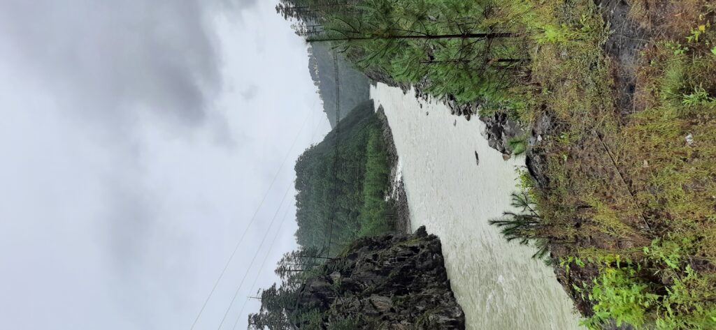
The road narrows as the foliage gives no quarter. Looking at the transmission line climbing up the steep slope past a rock face makes me wonder for the nth time how is it laid! The jungle camouflages the road entirely as we make our way past that rock face in a bit! A newer, more level road is being constructed around the hill but it is pretty much still a dirt track with umpteen slips. So we climb up and down the looping road through Hawa Pass in the dark. Although its just about 5 in the evening, night has fallen with a strange ambient glow. The black hills are silhouetted against a charcoal grey sky as white clouds float in the valley.
We cross Tidding bridge on its namesake river and climbing up on a broken village road masquerading as a highway we hit truck traffic! Very soon it is no more than a slushy track when suddenly a landslide halts us. A boulder has landed in the middle of the road. In the dark the only sound is of running water on the slope bringing more stones clattering down. Heavy duty machinery swings into rescue and a short walk across a mound of sliding silt and a change of vehicle has us in Hayuliang warming up with a brandy in hand as the rain now drums on the roof.
Travel on a better road lesser explored in –At the Darwaza of a Road Less Travelled
So long Hayuliang
As we start for Walong Sitrang swirls around gently the next morning too, making the little overgrown village of Hayuliang a blur. While we wait for another landslide to be cleared, standing in the drizzle, we watch the river froth over gentle rapids at a bend where trees dip their green fingertips into the water. The clouds are constantly on the move. Skimming the water, wafting through the trees.
The road here onwards is a dream run mostly. Only at Moody nala we come to a screeching halt. The bridge is not yet complete and Moody nala is in snitty spate. A change of vehicles into a higher 4/4 and we plunge into the teapot tempest. My latent ostrichness come to the fore and I shut my eyes and start praying. I had been willing to walk across the very short bridge!
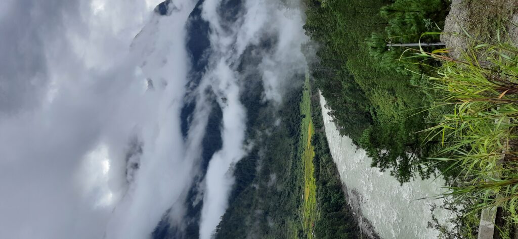
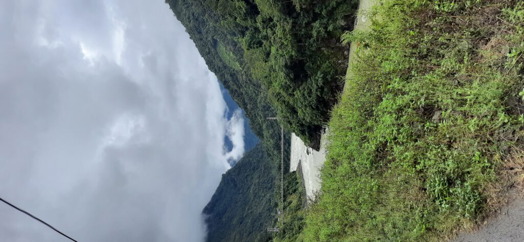
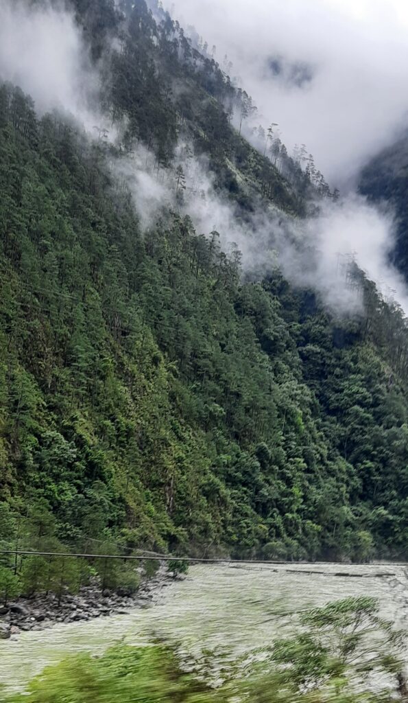
Vehicle and driver prevail but not before I glimpse almost half the vehicle submerged in rushing, swirling water! The rest of the way to Walong is on a gentle road along the river through ranges covered with thick tropical forest and peaks lost in the clouds.
Explore-Mandu and Maheshwar in the Monsoon Mist
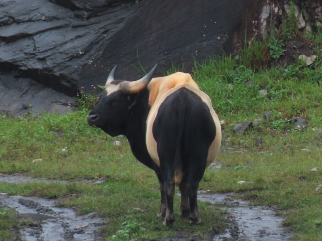
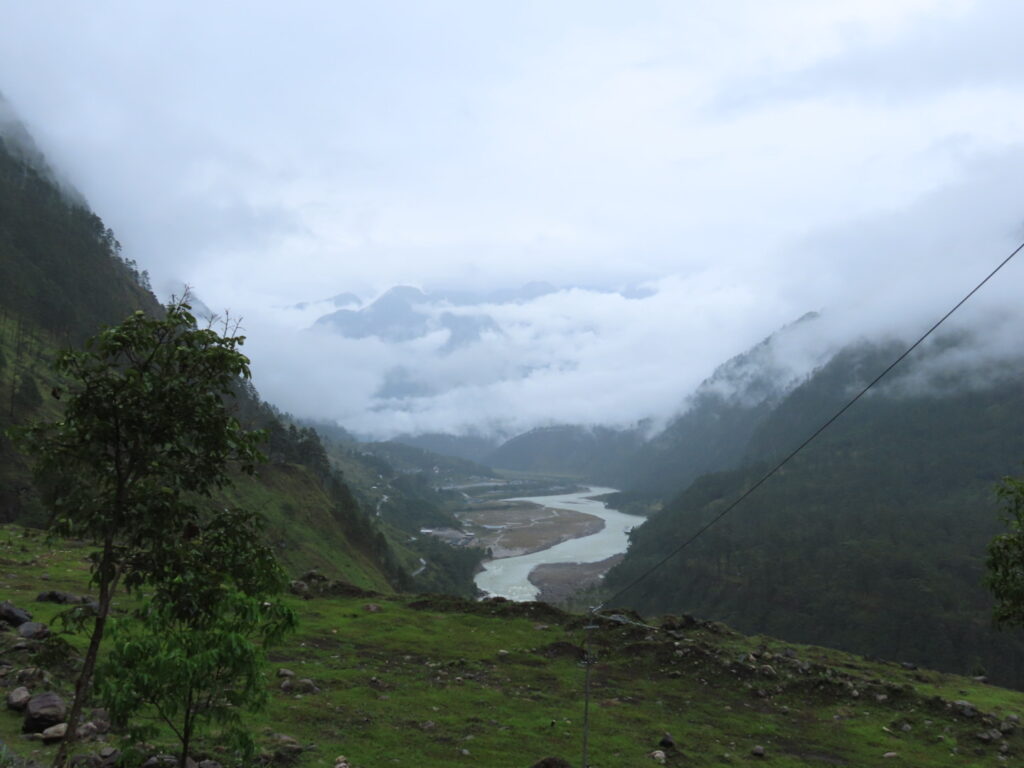
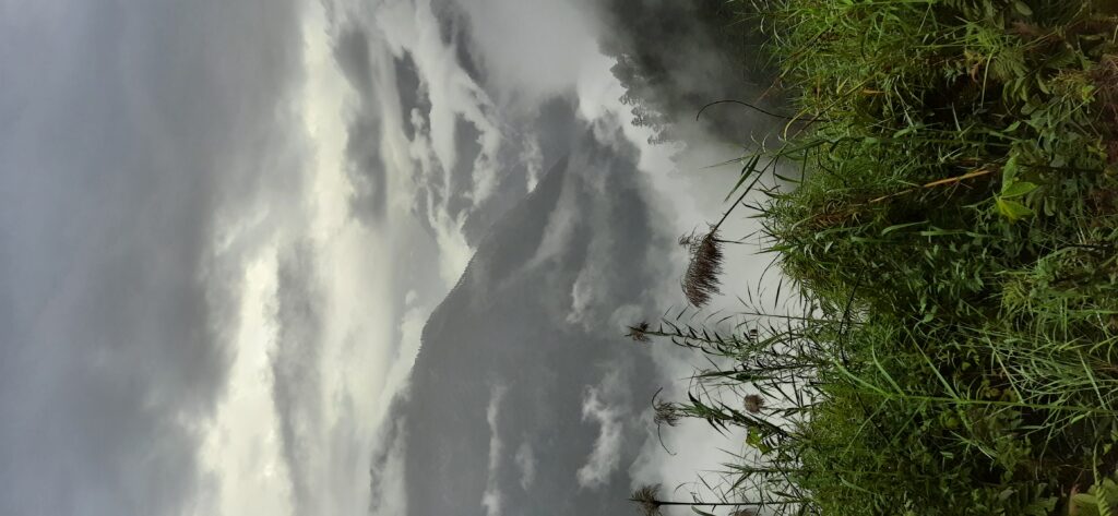
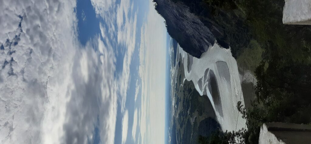
On steep slopes, houses of thatched bamboo pop up now and then, with signs of ‘slash and burn’ cultivation around. Swaying footbridges connect the two banks. We see a magnificent specimen of a Mithun, the prize possession of the Mishmi tribals. Ramshackle wooden shops line the road now and then, their window sills bare of wares and then just as suddenly from one hill to the next, the deep evergreens give way to a reddish brown burnt slope of pine and grass. The range curves and the valley widens into a bowl with Walong on a side.
Walong is a Grove of…
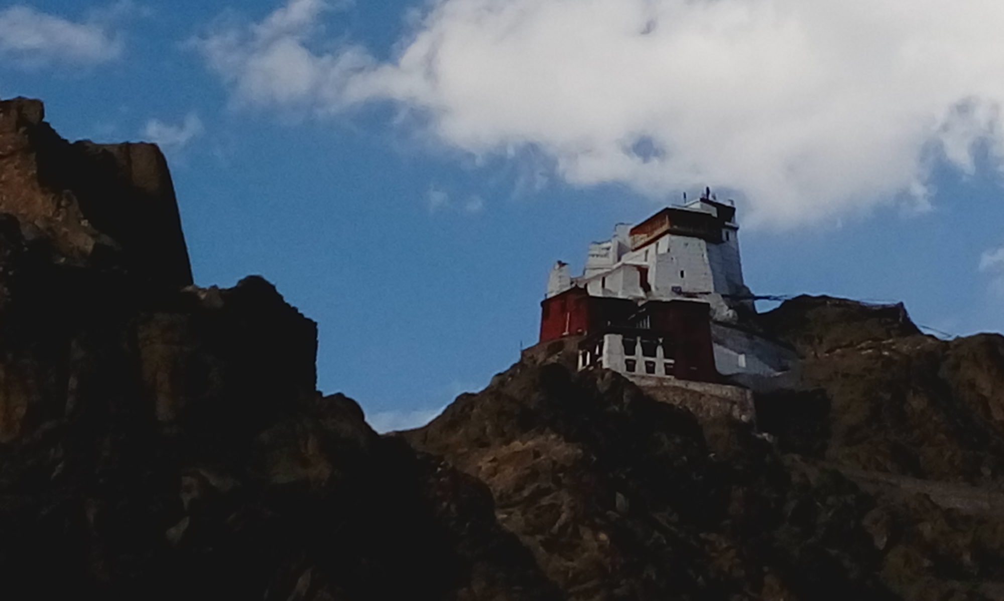
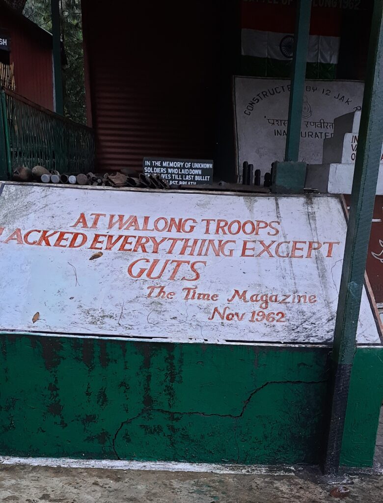
Walong meaning a place of bamboo groves in Mishmi still looks like a big village… with groves of unripe oranges trees and an airstrip! A memorial at one end of town on the road reminds us of the battle for Walong. The Chinese came over the mountains into the valley since they could not make their way along the Lohit.
We drive up 18 km after lunch to Helmet Post, site of a fierce battle where till years later clothing and battle gear still emerge in the thick undergrowth. We startle a family of pheasants out for an early supper into flight. Across the valley the rising clouds thinly thread through tall pines. Nobody has seen much wildlife around. Frankly speaking when every inch of land is covered in foliage, if it didn’t want to meet you, you wouldn’t even know its there…
Kaho in a Corner
In the land of sagging, swaying bridges we walk across the biggest one to Dong village the next morning…aptly called MSB or Mule Suspension Bridge. If it can take a mule it can take me….The FSBs I refuse to put a foot on! Dong village, comprising all of five to seven huts from what I can see, is famous because a small meadow on a nearby hill called Upper Dong is where the sun’s rays first fall in India.
From there it is a drive under hidden waterfalls and across the ripening mellow yellow fields of Meshai village to reach Kaho. India’s easternmost village is inhabited by the Buddhist Meyor tribe, now divided between two countries. We meet the Gaon Burra or village head and a few other villagers at the simple temple on one end of the village. Other than a lack of educational opportunities they seem a contented lot. The GB proudly shows us his homestay. A simple long wooden house with bright geraniums lining the veranda. He will find many takers…we crossed quite a few soaked bikers. At the far end of the village disappearing into the trees are white flags…prayers in the wind for departed souls. Across the Lohit a sheer rock face seems to have a road running across..can’t be…
Another border village and unforgettable river-Chushul &Chumathang – Hello Indus & Iridescent Colours!
Watch out at Wacha
We are crossing that rock face and I have my heart in my mouth again as I look down the sheer fall into the river below. The drivers by now have my vote though. We reach the BPM (Border Post Meeting) ‘hut’ at Wacha. Its like a fancy resort… I go to the loo.. It is a fancy resort! This is where the Chinese and Indians wine, dine and show their cultural prowess during their border meets. Its a complex of AC conference halls and glass huts etal under pine trees beside the Lohit. A lone soldier keeps vigil by the river, oblivious to the never ending drizzle.
Kibithu’s Cookies Melt in the Mouth
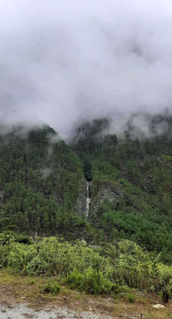
After a night at Kibithu, a tiny hamlet of wooden huts perched on a flattish hill with a bird’s eye view of pristine waterfalls and on a clear day of a long TAR valley we make an early start back. Not before we visit the bakery run by local women. They’ve been helped by the army and trained by an NGO from Pune. We find fresh faces offering fresher coconut cookies and chocolate muffins for the journey back.
The long drive back is without hiccups. At Namti an Eurasian Krestel chases a pair of tiny birds into the pines ringing the ‘plains’. The window sills of the shops enroute are now stacked with pineapples and the wizened old lady I had glimpsed earlier with a silver pipe has vacated her chair outside a hut for a younger, cigarettes smoking woman. Men on bikes whiz by sporting traditional waistcoats armed with dahs, a common accessory, sometimes even a rifle. A Mithun now and then lumbers across the road. Tiny goats in an inflated sense of self doze in the middle of the now dry road. The clouds are lifting and the sun warms the wings of giant black butterflies with flashes of blue and red. The Lohit bends one last mountain before leaving for the plains, stretching its arms wide….
Fact File–
Distance- Its approx 363 kms from Dibrugarh to Walong.
Hayuliang to Hawai is 56kms.
Staying- Hayuliang has one odd very run down hotel. It is better to stay at Hawai, the district HQ. It has a Circuit House and an old Inspection Bungalow.
Walong- Has a PWD IB and a few basic homestays.
Tilam about 5 kms ahead of Walong has a Government tourist lodge. It has a hot spring nearby too.
Kaho- The Gaon Burra has a simple homestay with a bedroom and dormitory. Its on a first come first serve basis till now.
Coverage-
The mobile coverage is very patchy ahead of Tidding bridge. There is no mobile coverage ahead of Hayuliang. Infact your phone timing will jump about 2 hours!
Discover-Disconnecting with the World on a Mountain Isle at Shaama