Discovering Dibang Valley, the Last Frontier

Loud woops suddenly rend the air as we climb towards Mayodia pass. As I jump from the vehicle with the camera the driver, as excited as me, says ‘van manush’, literally tree man or ape. A Hoolock gibbon! Through the thick greenery I spy a black shape swing adeptly on the vines draped across the trees. The call is returned from above the road. In the end though, all I get is a blurry shot of a black face and the unmistakable white brows! (soon enough there was an opportunity to be within touching distance of one…another story for another time) We are off to a good start into the folds of Arunachal again.

Read-Along the Lohit on the Long Road to Walong

The last frontier.

Gateway to Heaven

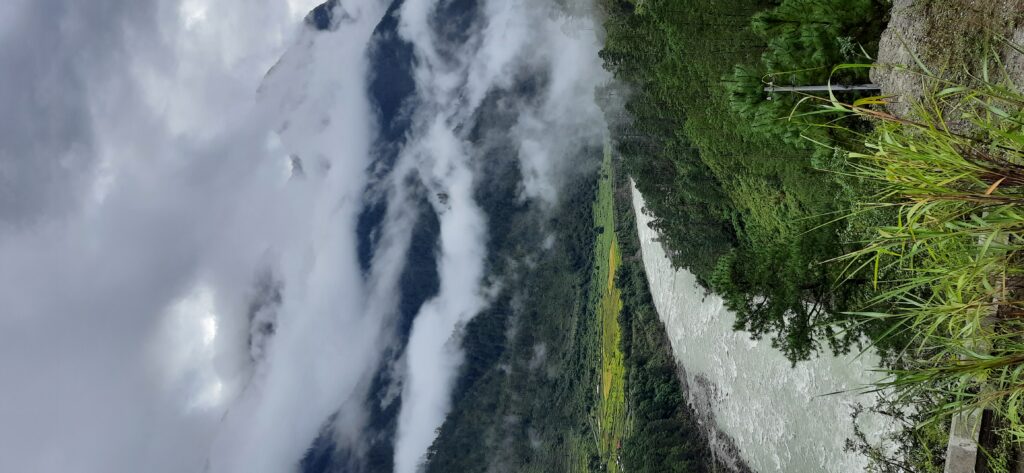
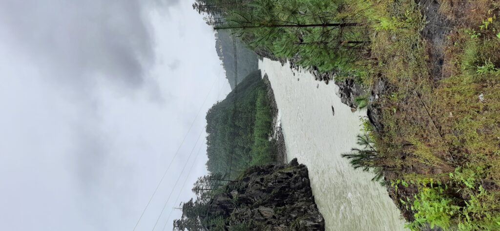
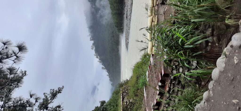
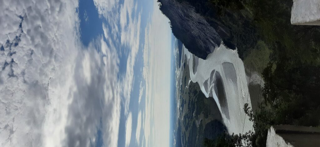
Anini, deep inside the Dibang Valley, home to the Idu Mishmis, has been on the itinerary for months but the year and the season are coming to a close when we cross the Dhola Sadiya bridge over bleached sandbanks of a drying Lohit. Past mustard fields a mellow yellow green and silver tinged bullrushes.

Dream in mustard yellow.

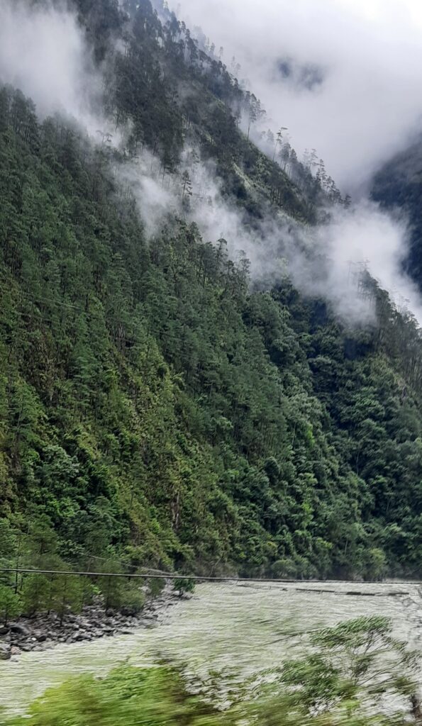
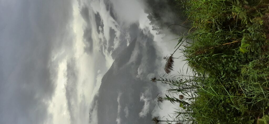
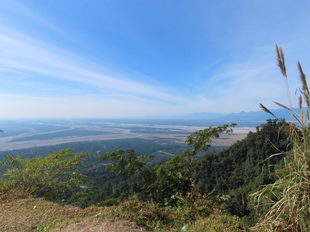
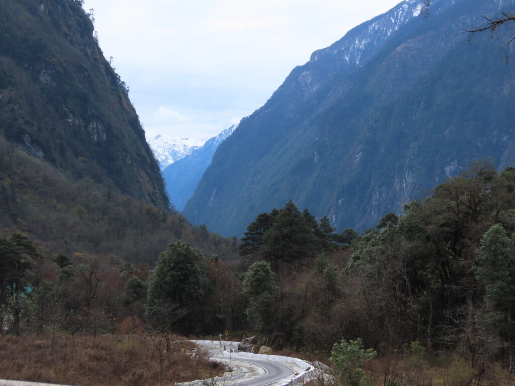
In Roing, the Christmas stars are off the shop shelves and on the neat houses lining the road. We climb an invisible road to Mayodia pass, the go-to-place in winter for snow for the Assamese around. It is well camouflaged by the thick foliage as it snakes up the mountain. On one hand of the pass the Lohit, Dibang and Siang merge in the hazy horizon to form the mighty Brahmaputra and on the other extend snow capped ranges and deep valleys like crumpled paper till Andra La on the northern border with Tibet and somewhere in Upper Dibang lies the lost Pemako, the ‘promised land’ of the Tibetans. Into this remote fecund land we descend after a perfunctory stop to take in the clouds flowing down like water over densely forested ranges.

The making of the mighty Brahmaputra.

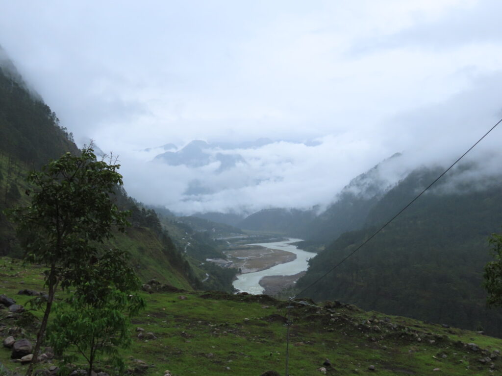
The village of Hunli is visible at the bottom on a shoulder seemingly in a face-off with drawing book mountain rising from the depths with its arms outstretched, every inch covered in thick forest. At Hunli we nearly take off towards Hayuliang on a shiny new road since there is almost no signage pointing towards Anini. It is a long drive into the crumpled ranges along the Dibang. By the time we reach Anini, Orion the Hunter is rising and has one boot on a peak and his belt looks like a three star tower. So close to the clear heavens!

Tall Mountains and Towering Falls

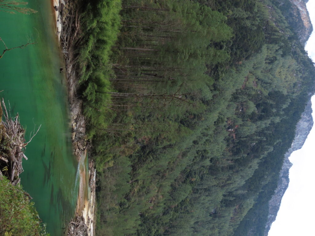
Anini sits on a plateau at the confluence of two rivers draining two valleys. Dri, the picturesque Angrim valley and Mathun, a narrower namesake. It is a small town and a district headquarter. After a night in near freezing temperature, it is an early start into the Angrim Valley under a slightly dour sky. A sparkling Dri keeps company, mostly skipping and rushing over boulders, at places resting calmly in crystal-clear emerald pools cradling sunken logs and fish.

Another river tale is- Barot And the Serendipitous Catch in the Uhl River

If emerald were a river….

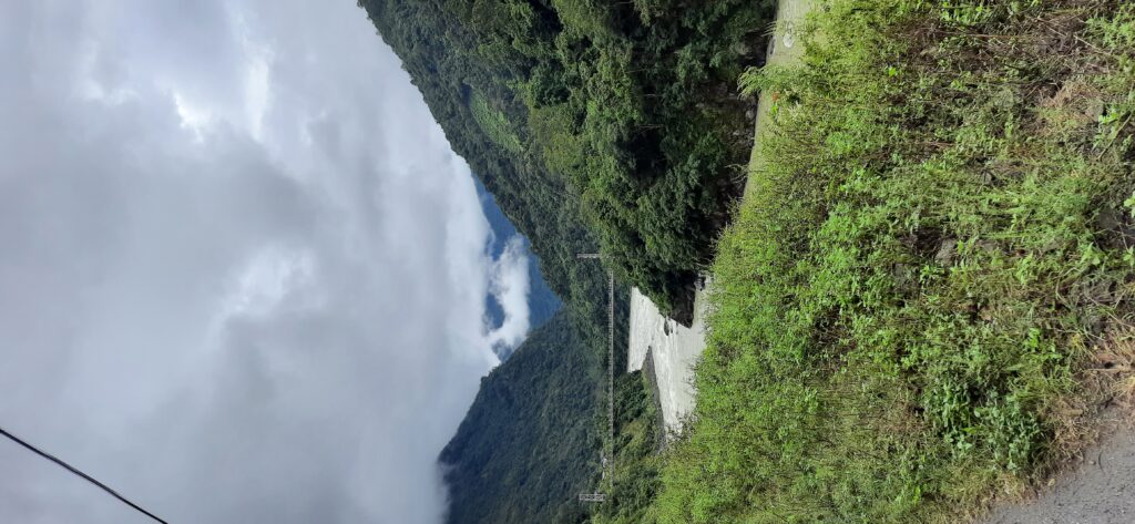
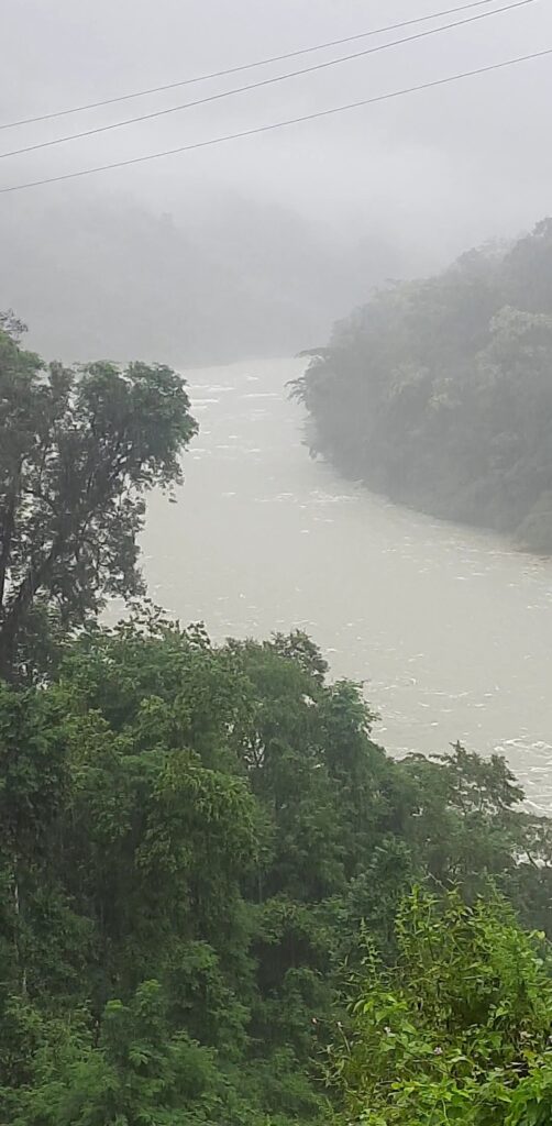
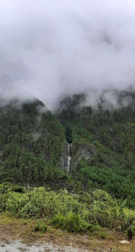
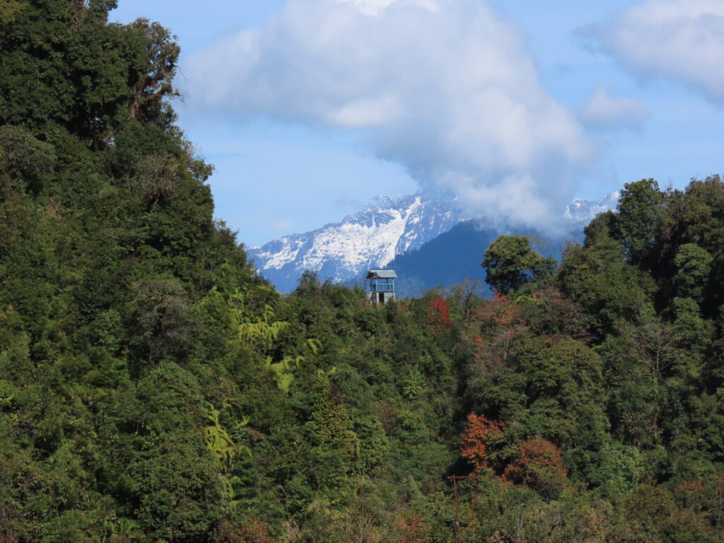
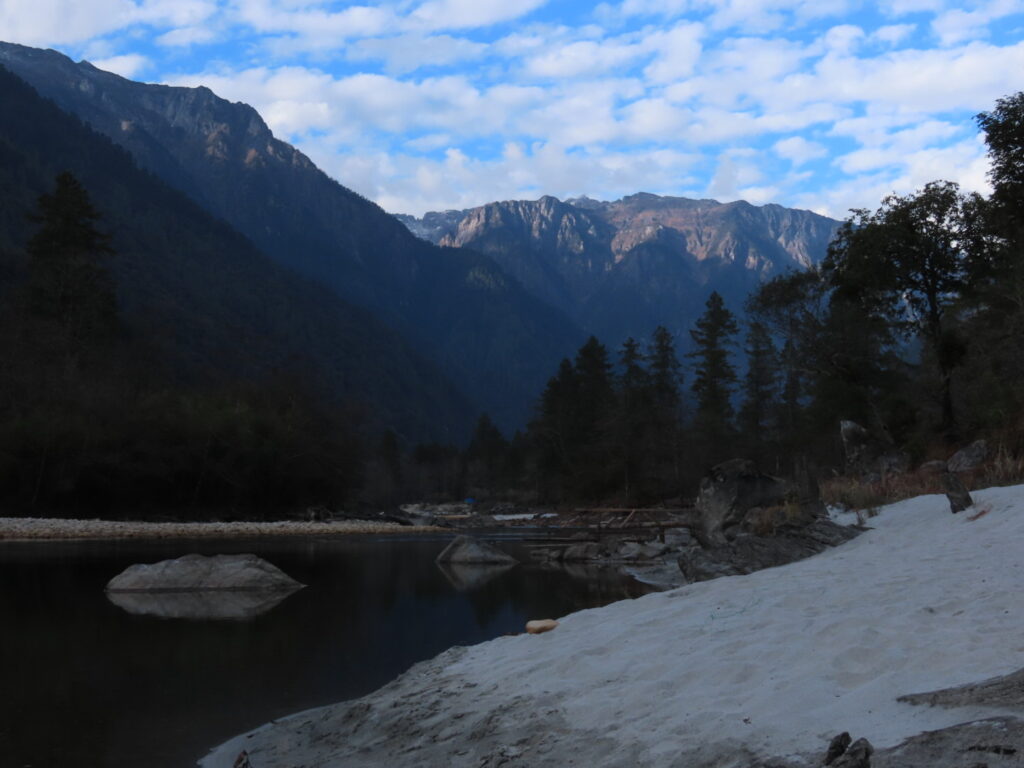
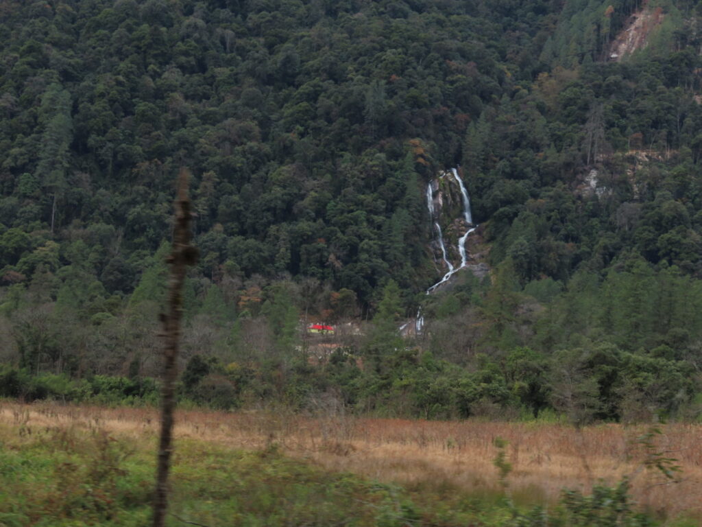
The valley rises gently and after Acheso village it widens into a rolling meadow of copper ferns. One can only imagine the greenscape it would be post monsoon. Soon we are deep inside the Dibang Wildlife sanctuary. Waterfalls dot the mountains as the valley narrows and we reach the Insta famous Chigu resort on a massive sandbar. A healthy respect for rivers in the mountains and the need to keep them at a distance is so ingrained that being on a river bed is a little disconcerting. After the customary photographs (it is quite a picture with the wooden and red roofed alpine huts on wooden platforms with the towering Chigu Falls and snow peaks as backdrop) we head for the Mawu Aando Falls.

Sculpted by Nature

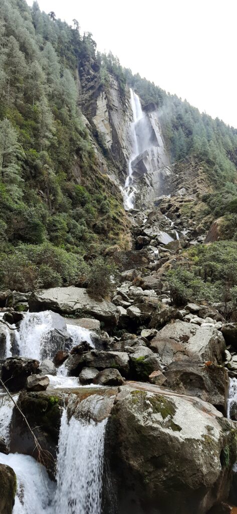
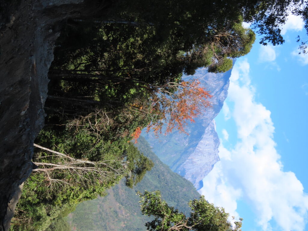
The short walk to it is a teaser of what hiking in these parts would be like. Walking on fallen mossy logs, climbing root steps takes us to a waterfall where the mountain looks like it has been chiselled precisely and at perfect angles by a machine. A thoughtfully made wooden platform and a low bench faces the water flying of the rockface. A place to meditate! Back on the road the drive ends abruptly a little beyond Brueni. There is only a wild forest of towering pines and boulders but soon it will give way to man and his machines.

On the road to ruin.

Dream Ride along the Dre

Our plan is to cycle back from Brueni to the Dree-Afra campsite. I test out the brakes (the only things that matter!) before we roll down. Off we go in the bracing cold which makes my eyes water. It is an exhilarating dream run on an excellent yet nearly deserted road. Down a narrow valley enclosed by snow-capped, thickly forested steep ranges.

Ride through- Cycling in Dehradun – The Best Routes for Leisure Rides

Dibang Dreamscape

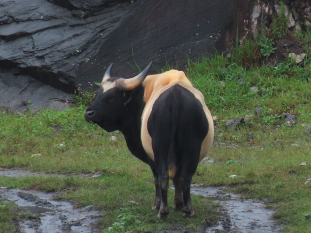
The thirty five odd kilometers end much too soon. I try to take in the fleeting scenery but one needs to keep an eye (watering and wandering!) on the road. A Mithun moves ruminatingly on a golden slope as we turn for the resort with it’s white beach for a late lunch. Still waters mirror the mountains and clouds. Redstarts quiver around on the boulders. With the light fading the cold returns with vengeance.

White sand and serene water.

Holy Night

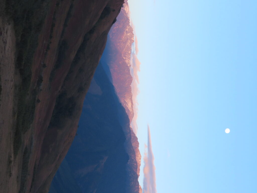
Back in Anini, from the heights above it, in the descending dusk, we watch a falcon hunt it’s supper before a silver full moon rising above the pink snow peaks leaves us starstruck. Being Christmas eve, we are treated to carol singing by a group of locals who with their innate musical talent and joyful fervour have us singing along soon enough albeit with a limited repertoire. Silent Night is the only suggestion I can give when asked! But what we lack in substance we make up in enthusiasm.

For more carol stories read- 3 Churches in Mhow: Discovering Obscure History and Outstanding Carols 

Moon by the mountains


Women of the Valley

Next day while heading to Matu Fall we cross a small village of barely a dozen houses. Orange trees laden with the tiny, deliciously sweet and juicy fruit and drying vines of Kiwi plantations dot the area. The houses are a colourful lot on low stilts. We walk past a kitchen garden which looks like a miniature edible jungle, wild and organic. The path ends at a house with an open gate.

Picture Perfect Porch

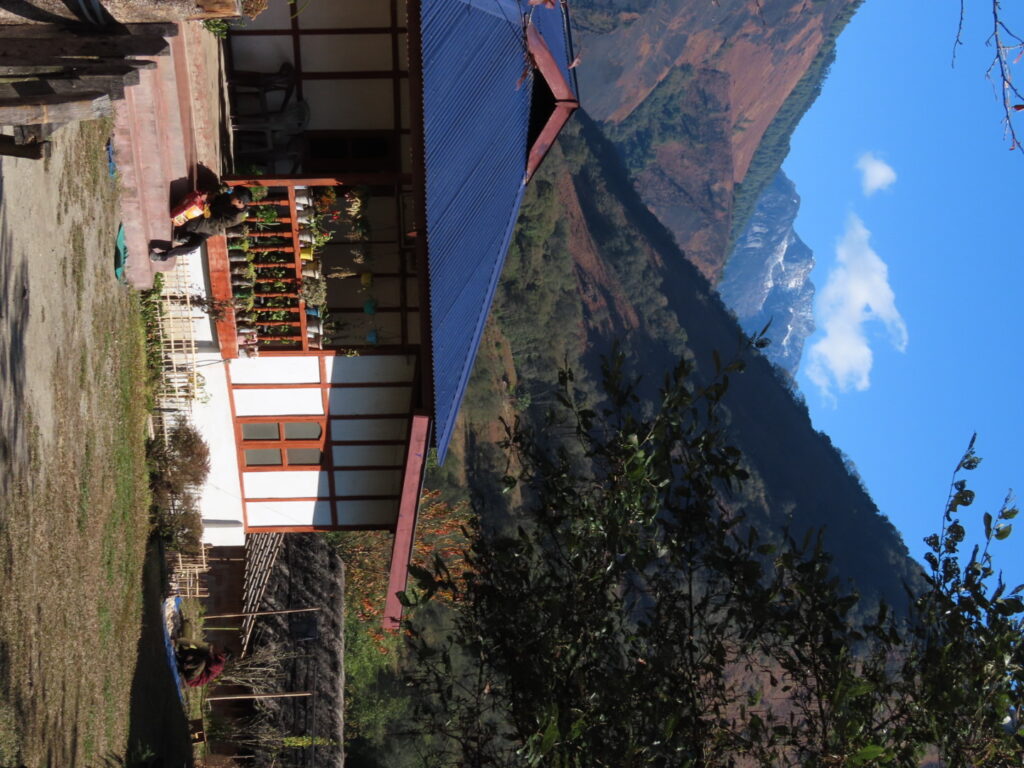
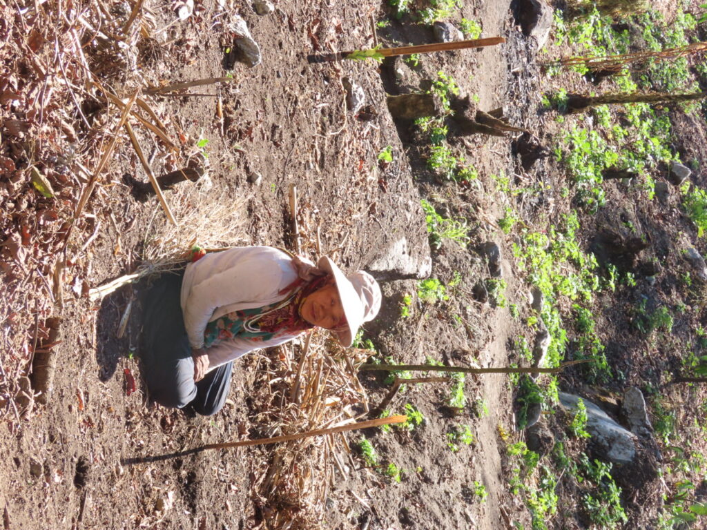
A woman is chopping a banana trunk. Breakfast for the pigs we are told by the grandson of the owners. The lady of the house is supervising and given the language barrier the grandson who studies in Anini and speaks fluent hindi translates. Her weathered smiling face begs to be photographed but she isn’t dressed up, translates the grandson. (haha..I understand!)Mithun horns line the ledge of a small traditional structure outside another house. Ahead in a steep field an old lady painstakingly clears the shrubbery. A smile is a language that needs no interpretation.

Also read- At the Darwaza of a Road Less Travelled

A Lady on her Land.

At Matu Falls a mini dam and a resort is being constructed and beyond, a new road is being cleaved from the mountain. It is a graveyard of massive massacred trees, hacked and strewn. Somewhere up in the higher reaches is the famous Seven Lake trek of Arunachal. Glacial beauties right now only accessible to the few tough and brave enough to venture into this last frontier. Somewhere I hope it stays a ‘Pemako’, famed but lost to man.

Falling water and a climbing road.

Fact File-

Getting There-Dibrugarh(376 km) is the nearest airhead. Tinsukia(326km) the nearest railhead. Then a taxi.

Staying– Dree Afra Campsite offers tents. There are a few simple homestays and hotels in Anini. The Chigu Camp is not operational.

Best Season- October to April.

Along the Lohit on the Long Road to Walong

To cross over to Tibet from India one envisages traversing across snow bound passes. Nigh impossible in most seasons. But there is one all-weather pass which the Chinese used in the ’62 war for entering India to reach Walong. It was a maw so fiercely defended they called it the Tiger’s Mouth. Here in the eastern most Indian valley of Namti, the Himalayas part for the gushing, rushing Lohit. To call it a mere tributary of the mighty Brahmaputra is an exercise in semantics. There is nothing mere about the ferocious and unforgiving waters, cradled by steep ranges, covered in a canopy of evergreen forests constantly being fed by the rains and rivulets.  Into this fecund land of excesses we take a driving holiday.

How much is too much..of beauty?

We have waited for the monsoon to retire but well into October and it seems to be on climate change steroids. And now cyclone Sitrang is heading our way so between Mechuka (where no flight will go for the next 2 weeks), Dzukou (trekking in the rain is not my idea of fun) and Walong, the safest(haha…!) bet is to sit dry in a vehicle and drive!

Tezu: A Foot in the Hills
There is a light drizzle when we start and it keeps company through the day. The pot-holed bypass of Tinsukia is familiar till we take a better option through Makum. Crossing into Arunachal sees a dramatic improvement and we breeze past Kongmu Kham or the Golden Pagoda where expansion work is on in earnest. The Lohit before Tezu is a latte coloured meandering mass. We hit the hills in the quickly fading light post lunch at Tezu, a little town wedged between the hills and the river where the silversmiths are masters of upscaling (much before it was even a word) silver coins from all over the country into tribal jewellery for the Mishmi tribe whose land this is.

Prized Possession

Read about intrepid merchants in-Bikaner’s Merchants and Their Mansions

The road narrows as the foliage gives no quarter. Looking at the transmission line climbing up the steep slope past a rock face makes me wonder for the nth time how is it laid! The jungle camouflages the road entirely as we make our way past that rock face in a bit! A newer, more level road is being constructed around the hill but it is pretty much still a dirt track with umpteen slips. So we climb up and down the looping road through Hawa Pass in the dark. Although its just about 5 in the evening, night has fallen with a strange ambient glow. The black hills are silhouetted against a charcoal grey sky as white clouds float in the valley.

In the the land of bridges

We cross Tidding bridge on its namesake river and climbing up on a broken village road masquerading as a highway we hit truck traffic! Very soon it is no more than a slushy track when suddenly a landslide halts us. A boulder has landed in the middle of the road. In the dark the only sound is of running water on the slope bringing more stones clattering down. Heavy duty machinery swings into rescue and a short walk across a mound of sliding silt and a change of vehicle has us in Hayuliang warming up with a brandy in hand as the rain now drums on the roof.

Travel on a better road lesser explored in –At the Darwaza of a Road Less Travelled

So long Hayuliang
As we start for Walong Sitrang swirls around gently the next morning too, making the little overgrown village of Hayuliang a blur. While we wait for another landslide to be cleared, standing in the drizzle, we watch the river froth over gentle rapids at a bend where trees dip their green fingertips into the water. The clouds are constantly on the move. Skimming the water, wafting through the trees.

Green fingers dipping into the river.

The road here onwards is a dream run mostly. Only at Moody nala we come to a screeching halt. The bridge is not yet complete and Moody nala is in snitty spate. A change of vehicles into a higher 4/4 and we plunge into the teapot tempest. My latent ostrichness come to the fore and I shut my eyes and start praying. I had been willing to walk across the very short bridge!

More like walking the plank, this one!

Vehicle and driver prevail but not before I glimpse almost half the vehicle submerged in rushing, swirling water! The rest of the way to Walong is on a gentle road along the river through ranges covered with thick tropical forest and peaks lost in the clouds.

Wonderland

Explore-Mandu and Maheshwar in the Monsoon Mist

On steep slopes, houses of thatched bamboo pop up now and then, with signs of ‘slash and burn’ cultivation around. Swaying footbridges connect the two banks. We see a magnificent specimen of a Mithun, the prize possession of the Mishmi tribals. Ramshackle wooden shops line the road now and then, their window sills bare of wares and then just as suddenly from one hill to the next, the deep evergreens give way to a reddish brown burnt slope of pine and grass. The range curves and the valley widens into a bowl with Walong on a side.

A Cauldron of Clouds

Walong is a Grove of…
Walong meaning a place of bamboo groves in Mishmi still looks like a big village… with groves of unripe oranges trees and an airstrip! A memorial at one end of town on the road reminds us of the battle for Walong. The Chinese came over the mountains into the valley since they could not make their way along the Lohit.

Truth acknowledged

We drive up 18 km after lunch to Helmet Post, site of a fierce battle where till years later clothing and battle gear still emerge in the thick undergrowth. We startle a family of pheasants out for an early supper into flight. Across the valley the rising clouds thinly thread through tall pines. Nobody has seen much wildlife around. Frankly speaking when every inch of land is covered in foliage, if it didn’t want to meet you, you wouldn’t even know its there…

Layers of Nothing


Kaho in a Corner
In the land of sagging, swaying bridges we walk across the biggest one to Dong village the next morning…aptly called MSB or Mule Suspension Bridge. If it can take a mule it can take me….The FSBs I refuse to put a foot on! Dong village, comprising all of five to seven huts from what I can see, is famous because a small meadow on a nearby hill called Upper Dong is where the sun’s rays first fall in India.

Where do you come from, where do you go?

From there it is a drive under hidden waterfalls and across the ripening mellow yellow fields of Meshai village to reach Kaho. India’s easternmost village is inhabited by the Buddhist Meyor tribe, now divided between two countries. We meet the Gaon Burra or village head and a few other villagers at the simple temple on one end of the village. Other than a lack of educational opportunities they seem a contented lot. The GB proudly shows us his homestay. A simple long wooden house with bright geraniums lining the veranda. He will find many takers…we crossed quite a few soaked bikers. At the far end of the village disappearing into the trees are white flags…prayers in the wind for departed souls. Across the Lohit a sheer rock face seems to have a road running across..can’t be…

Leading man

Another border village and unforgettable river-Chushul &Chumathang – Hello Indus & Iridescent Colours!

Watch out at Wacha 
We are crossing that rock face and I have my heart in my mouth again as I look down the sheer fall into the river below. The drivers by now have my vote though. We reach the BPM (Border Post Meeting) ‘hut’ at Wacha. Its like a fancy resort… I go to the loo.. It is a fancy resort! This is where the Chinese and Indians wine, dine and show their cultural prowess during their border meets. Its a complex of AC conference halls and glass huts etal under pine trees beside the Lohit. A lone soldier keeps vigil by the river, oblivious to the never ending drizzle.

A guard’s viewing post/A ridge too far.


Kibithu’s Cookies Melt in the Mouth
After a night at Kibithu, a tiny hamlet of wooden huts perched on a flattish hill with a bird’s eye view of pristine waterfalls and on a clear day of a long TAR valley we make an early start back. Not before we visit the bakery run by local women. They’ve been helped by the army and trained by an NGO from Pune. We find fresh faces offering fresher coconut cookies and chocolate muffins for the journey back.

Battle Hardened

The long drive back is without hiccups. At Namti an Eurasian Krestel chases a pair of tiny birds into the pines ringing the ‘plains’. The window sills of the shops enroute are now stacked with pineapples and the wizened old lady I had glimpsed earlier with a silver pipe has vacated her chair outside a hut for a younger, cigarettes smoking woman. Men on bikes whiz by sporting traditional waistcoats armed with dahs, a common accessory, sometimes even a rifle. A Mithun now and then lumbers across the road. Tiny goats in an inflated sense of self doze in the middle of the now dry road. The clouds are lifting and the sun warms the wings of giant black butterflies with flashes of blue and red. The Lohit bends one last mountain before leaving for the plains, stretching its arms wide….

Freedom or Loss?


Fact File

Distance- Its approx 363 kms from Dibrugarh to Walong.

Hayuliang to Hawai is 56kms.

Staying- Hayuliang has one odd very run down hotel. It is better to stay at Hawai, the district HQ. It has a Circuit House and an old Inspection Bungalow.

Walong- Has a PWD IB and a few basic homestays.

Tilam about 5 kms ahead of Walong has a Government tourist lodge. It has a hot spring nearby too.

Kaho- The Gaon Burra has a simple homestay with a bedroom and dormitory. Its on a first come first serve basis till now.

Coverage-

The mobile coverage is very patchy ahead of Tidding bridge. There is no mobile coverage ahead of Hayuliang. Infact your phone timing will jump about 2 hours!

Discover-Disconnecting with the World on a Mountain Isle at Shaama